V4-QHD | STRUCTURE MAPPING PRO

STRUCTURESCAN 3D PRO | PREMIUM APP UPGRADE! - NOW ONLINE!

World first for baitboats and industrial rovers - our fully integrated 3D Structure Mapping Pro.

Looking for hard or gravelly spots?
Worried about your rig sinking in the mud?

STRUCTURESCAN 3D PRO™ – the absolute top class in the high-end range!

No other wireless echo sounder offers anglers and industry customers such a high-resolution, intuitive and, above all, clear live display of water depth and bottom structure!

Besides the exact depth, the NEW STRUCTURESCAN 3D PRO™ feature reveals the bottom hardness levels of the mapped area and will be the most important factor for a precise spot selection!

” It has never been possible before to get such a precise overview of the bottom composition. Easily find mud-free hotspots with the New Structurescan 3D Pro™ feature from Carplounge!

And all of this directly and live in the app without having to use an PC and external programs such as Reefmaster. “

-Ali Hamidi

STRUCTURESCAN 3D PRO™ | DETAILS

Note: Add Video Here

Structure Map Overlay as an industry standard! 

While so far “only” pure 3D depth maps could be generated with the Carplounge 3D Mapping feature, but from now on we are using the full bandwidth of 7CH Element QHD Transducer to collect the ultra high resolution bottom structure data for the New Structurescan 3D Pro™ feature. In addition to the depth data, two additional data layers will be recorded with the Structurescan 3D Pro™ Upgrade to display the structure and hardness of the bottom in 3 Dimensional in their own layers:


Structure layer – bottom surface : The first echo that is reflected from the bottom (and typically has the highest reflectivity) is used to generate the map.

Structure layer – bottom structure: Here, in addition to the first echo, 10% of the further bottom/surface data is also used for the generation of the map.

MAP BOUNDARY MANAGEMENT | ISLANDS & SHORELINES

Map boundaries are polygons that can be added to a map to define the shoreline and islands of the mapped area.

These defined polygons contains zero depths and together with the collected mapping data it ensures optimized interpolation to generate detailed depth & structure maps to view in 3D / 2D or use as an overlay on top of the Google Earth background in the Carplounge app. This gives the best map overview and prevents all unwanted display errors!

Shore & zero lines
By simply tapping on the map, you can now directly mark the course of the shore on the map to create a defined ” shore line with zero depths”, Just like professional external applications such as Reefmaster.

Islands and Others Areas
Just like shorelines, islands and other areas of the mapped area can now be marked and can specifically excluded from the map.

Exclusively mark shorelines and add exclusions – such as islands – to the map generation. And all of this directly and live in the app without having to use external programmes like Reefmaster.


NEW ICON FOR QUICK MAP & OVERLAY SELECTION

Through the digital connection with our autopilot V4, the depth & structure data are directly and graphically processed in the V4 app.  With the structure mapping update, a new icon is available that can be used to easily switch between structure and depth maps while driving! 


Note: Add Video Here

Switch live between the different views to optimally identify fish, bottom structure and bottom hardness according to your preference and situation.


3D RENDERING PRO™ UPDATE | DETAILS


🔥 JULY ’22 // V4 MEGA MAPPING UPDATE ONLINE!

👉 Update now free of charge: https://play.google.com/store/apps/details?id=com.carplounge.pilot

Note: Add Video Here

Our JULY ’22 MEGA MAPPING update is our most comprehensive and complete update package so far. Over the past few months, our 5 full-time app developers have been thoroughly reviewing the V4 Element QHD data collection, data preparation and, most importantly, map creation for the current update. After an intensive 3 week testing phase, we are excited to take your RT4 V4 to a whole new level with this mega update! 


In addition to the long-awaited STRUCTURESCAN 3D PRO™ Premium Upgrade, the following features are now available to ALL RT4 V4 CUSTOMERS free of charge with the JULY UPDATE:   


// NEXT LEVEL MAPPING UPDATE | 3D Rendering Pro:

The map generation feature has been completely revised and the corresponding menu (UI) is now logically divided into 3 different areas “General”, “Details”, “Logs”. With the new 3D Rendering Pro features, the map becomes much more detailed and can be customised more according to your individual needs.

Note: Add Video Here

// 3D Rendering Pro:

For the generation of the map we have added the options smoothing degree and interpolation radius. This means that these parameters can now be specifically set/optimised for map generation.

3D depth scaling
A function for scaling the water depth has been added to the 3D map generation. This means that structures can now be recognised and highlighted even more clearly, especially on larger maps.

// Advanced Contouring

Contour lines can now be freely configured and optionally shown or hidden and the number of contour lines is now configurable

Depth info: The contour lines can now optionally be displayed with or without depth numbers.

Major/Minor contour lines can now be switched on or off independently of each other.

Note: Add Video Here

AUTO DEPTH UPDATE

This new feature can now be activated from the menu to automatically update and adding new depth data info to the map with every new RT4 drive.

Saved data points with no depth information are automatically updated when driving over them with the current depth info.

If automatic updating has been activated in the settings menu, points that already have depth information will also be continuously and fully automatically updated.

QUICKPOINTS FEATURE

With this update we have also improved the interaction with the 3D map itself. Many customers have asked for the possibility to create quickpoints directly in the 3D map view.

In this update we also answered this request and added the option to save points directly in the 3D map. These points are of directly saved with the corresponding depth information in the filename and can be used directly or later for routes.

Note: Add Video Here

SHALLOW WATER WARNING

With this update, the automatic shallow water warning, which has been highly appreciated by our customers, has been improved again.

In addition to the shallow water warning notice, the actual depth displayed in the header bar will now also include a signal warning indicating the shallow water depth.

Of course this can be switched off until the app is restarted.

| V4 PREMIUM APP UPGRADE CENTER

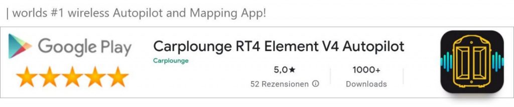
Our V4 apps are constantly being developed. Our customers can download the latest version of the most important and useful enhancements from the Playstore free of charge via an app update.

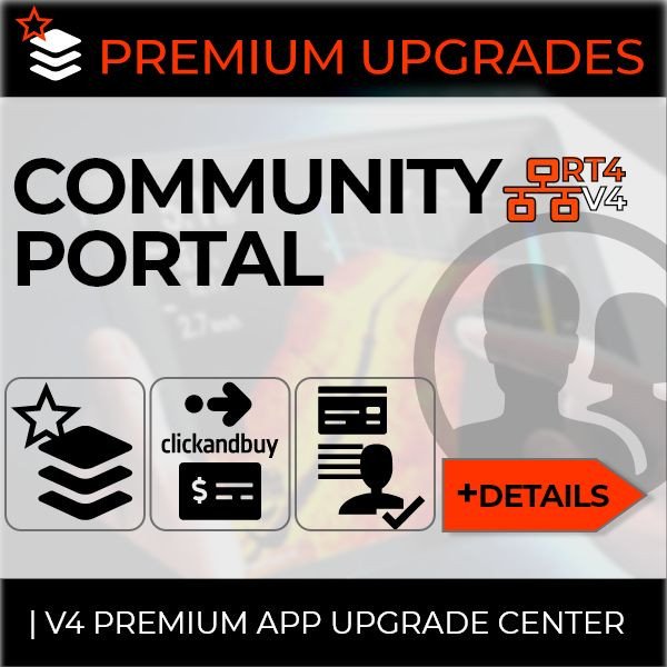
PREMIUM APP UPGRADES
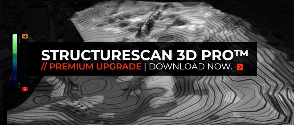
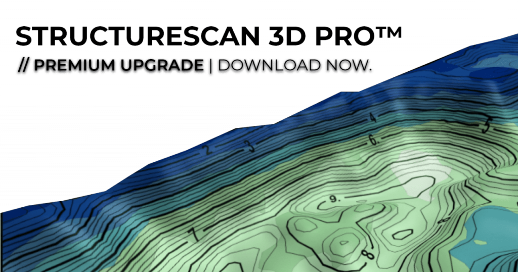
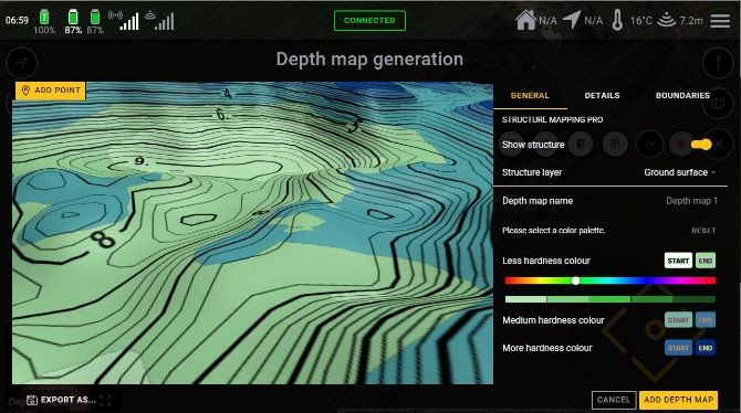
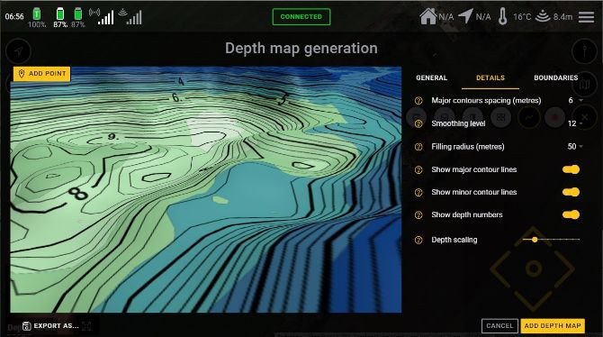
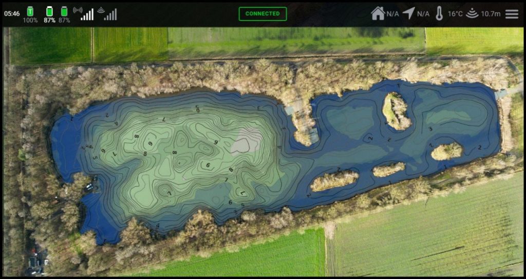
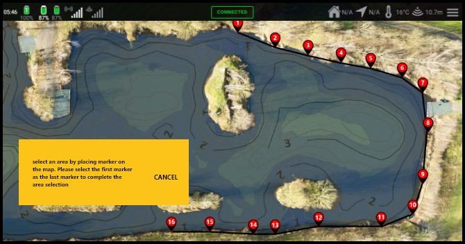
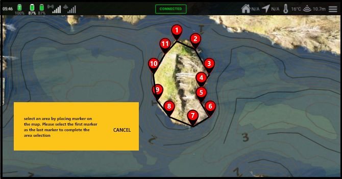
Extremely complex features such as REALVISION or STRUCTURE MAPPING PRO, which take hundreds of hours in development time, can be ordered directly from our website for an extra fee or purchased as an upgrade at a later date.

PREMIUM UPGRADES | UNLOCKING
From the December update onwards, our community portal will be available in the app. To activate premium apps, our customers can log into the community portal with your carplounge.de / carplounge.co.uk web shop account name and password. After logging in with the valid email address and password, paid premium app upgrades are activated, they are installed automatically and are then available directly in the app.

Cookie Guidelines

This website uses cookies to provide you with the best possible functionality. If you do not agree, the following functions are not available to you: